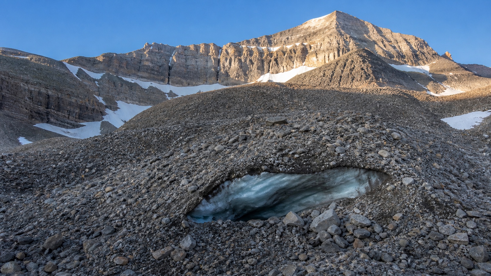
A new three-dimensional study of the Timpanogos Rock Glacier estimates that the formation contains about 1.55 million cubic meters of ice beneath its rocky surface. The result matters beyond one Utah mountain: the researchers used measurements from Timpanogos and ten other rock glaciers to build a relationship between surface area and ice volume, offering a way to estimate water stored in similar landforms around the world.
Key facts
- The preferred model estimates 1.55 million cubic meters of ice.
- The rock glacier averages 18.8 meters thick in the two-layer model.
- The modeled ice core is about 83% ice and 17% debris.
Timeline
In 2024 the team recorded gravity measurements across the rock glacier. The underlying data and reduction code were deposited in the University of Utah's Hive repository. The peer-reviewed study and the university's public research summary were published in August 2026.
Rock glaciers do not look like the clean, exposed ice most people picture. Their ice is insulated by loose rock, allowing them to persist in mountain settings where ordinary glaciers may disappear. That makes them potentially important stores of late-season water and habitat for cold-adapted species. It also means that a meaningful part of the mountain water system can remain nearly invisible in conventional surveys.
This is a scientific measurement, not a new water supply forecast. The broader estimates depend on scaling from a small number of well-studied sites, so they should guide further fieldwork rather than be treated as a precise inventory available for use.
What happened?
Researchers collected 232 gravity measurements on and around the Timpanogos Rock Glacier, then used a three-dimensional Bayesian model to infer what lies below the debris. Their preferred model indicates an average thickness of 18.8 meters and an ice-rich core that is about 83% ice. The study, published in the Journal of Geophysical Research: Earth Surface, estimates 1.55 million cubic meters of ice in the formation—roughly the volume of 600 Olympic-size swimming pools.
Why it matters
Rock glaciers do not look like the clean, exposed ice most people picture. Their ice is insulated by loose rock, allowing them to persist in mountain settings where ordinary glaciers may disappear. That makes them potentially important stores of late-season water and habitat for cold-adapted species. It also means that a meaningful part of the mountain water system can remain nearly invisible in conventional surveys.
Background
A new three-dimensional study of the Timpanogos Rock Glacier estimates that the formation contains about 1.55 million cubic meters of ice beneath its rocky surface. The result matters beyond one Utah mountain: the researchers used measurements from Timpanogos and ten other rock glaciers to build a relationship between surface area and ice volume, offering a way to estimate water stored in similar landforms around the world.
Who wins?
Mountain hydrology and climate research gain a practical tool for estimating ice where radar surveys can be difficult. Water managers may also get better regional estimates as more rock glaciers are measured directly.
Who loses?
Simple maps that treat rocky alpine landforms as ice-free can miss stored water. The study also underscores how little direct three-dimensional evidence exists for most of the world's rock glaciers.
Market impact
This is a scientific measurement, not a new water supply forecast. The broader estimates depend on scaling from a small number of well-studied sites, so they should guide further fieldwork rather than be treated as a precise inventory available for use.
Nivegu analysis
The striking number is the hidden ice under one familiar Utah peak, but the more durable contribution is methodological. Small changes in gravity can reveal the shape and composition of a debris-covered body without drilling through it. If researchers repeat that work across different climates and geology, the world's rock-glacier water estimates can move from broad approximation toward a measured inventory.
Different viewpoints
Mountain hydrology and climate research gain a practical tool for estimating ice where radar surveys can be difficult. Water managers may also get better regional estimates as more rock glaciers are measured directly.
Simple maps that treat rocky alpine landforms as ice-free can miss stored water. The study also underscores how little direct three-dimensional evidence exists for most of the world's rock glaciers.
What are you still wondering?
Answers will use this briefing and its cited sources.Sources and further reading
01Journal of Geophysical Research: Earth Surface — peer-reviewed study↗02University of Utah — research summary↗03University of Utah Hive — gravity data and code↗Questions, answered.
What is the short version?
A new three-dimensional study of the Timpanogos Rock Glacier estimates that the formation contains about 1.55 million cubic meters of ice beneath its rocky surface. The result matters beyond one Utah mountain: the researchers used measurements from Timpanogos and ten other rock glaciers to build a relationship between surface area and ice volume, offering a way to estimate water stored in similar landforms around the world.
Why does this matter now?
Rock glaciers do not look like the clean, exposed ice most people picture. Their ice is insulated by loose rock, allowing them to persist in mountain settings where ordinary glaciers may disappear. That makes them potentially important stores of late-season water and habitat for cold-adapted species. It also means that a meaningful part of the mountain water system can remain nearly invisible in conventional surveys.
What should readers watch next?
This is a scientific measurement, not a new water supply forecast. The broader estimates depend on scaling from a small number of well-studied sites, so they should guide further fieldwork rather than be treated as a precise inventory available for use.